

Smart Maps.
Smarter Decisions.
We deliver powerful mapping solutions that turn complex data into clear, actionable insights. From paper maps to interactive platforms, we help you make informed decisions with confidence.
Our Goal
We specialize in delivering high-quality mapping and geospatial consulting services tailored to the needs of small local governments. Whether it's crafting detailed paper maps like general plans and zoning maps, or building interactive GIS platforms, our goal is to make geographic data accessible, actionable, and impactful.
Our interactive maps enable both public users and government staff to explore, analyze, and make informed decisions with clarity and confidence. Acting as a contracted GIS department, we bring expert-level support without the overhead—helping communities thrive through smart mapping.

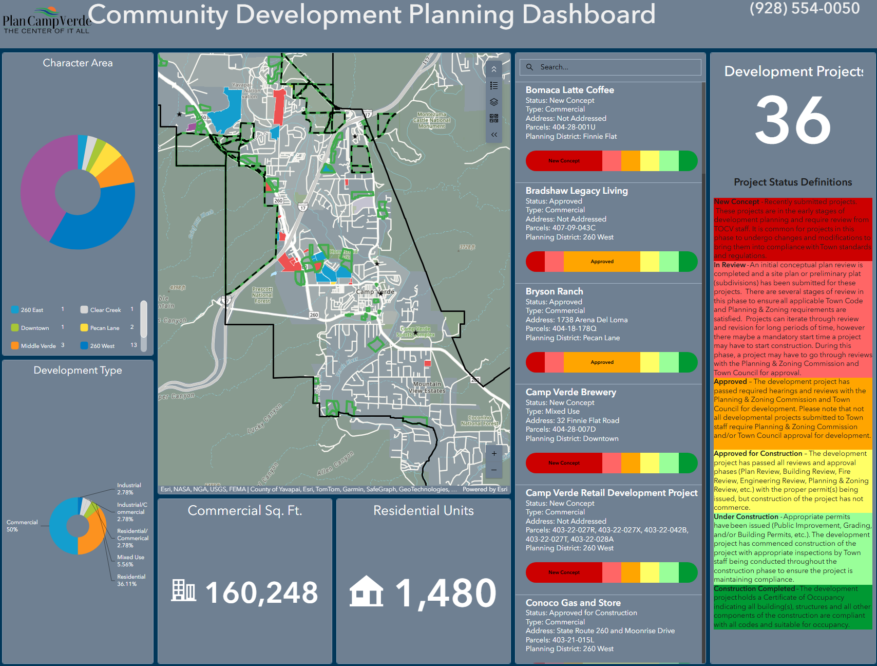
Interactive Web Map Applications
Our custom-built online GIS maps empower local governments and the public with intuitive, interactive tools for exploring geographic data. Whether it’s zoning, infrastructure, or public services, our maps make information accessible, searchable, and easy to understand.

Contracted GIS Department
We offer full-service GIS support as your contracted GIS department. We handle everything from data management and map production to spatial analysis and reporting—giving you expert capabilities without the overhead of an in-house team.
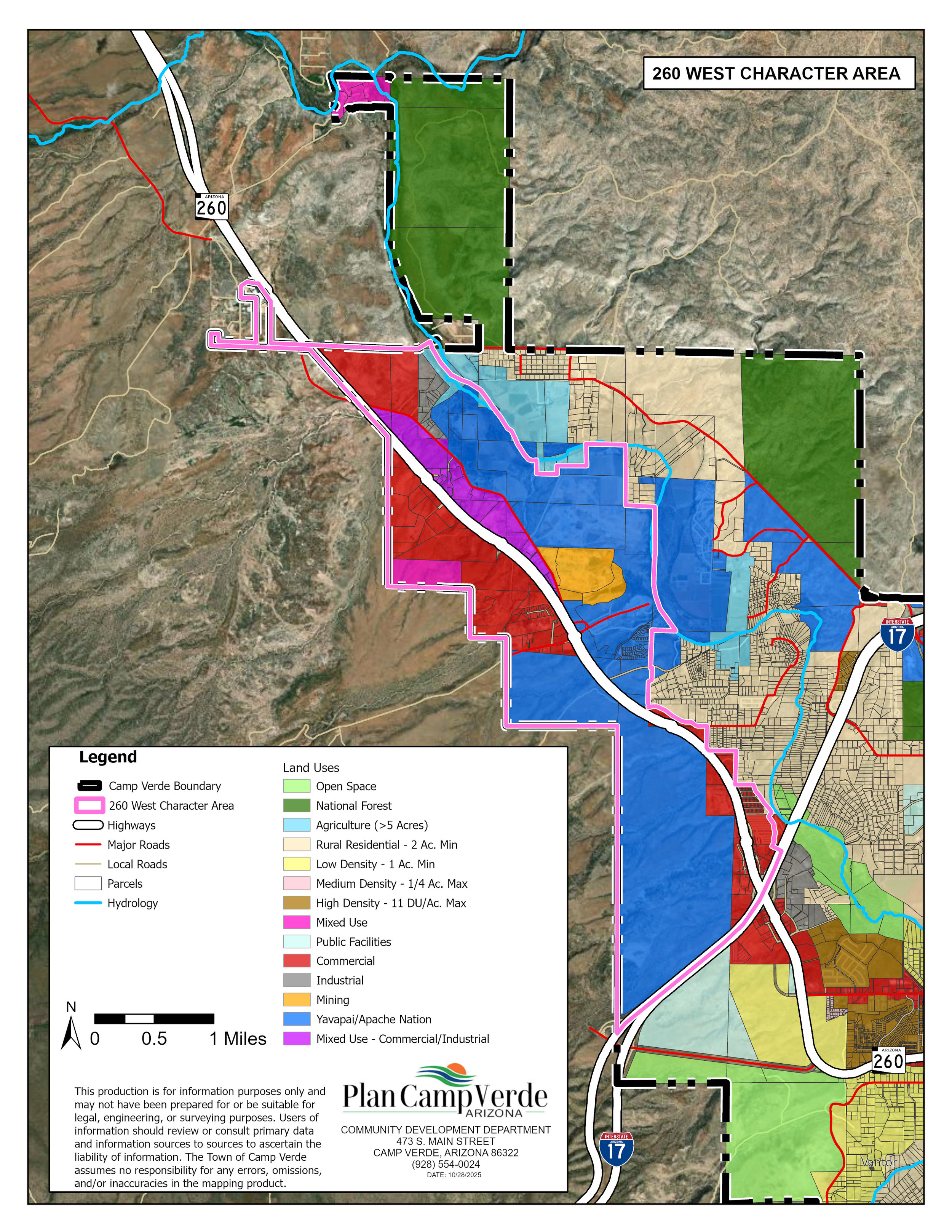
Paper Maps
We create high-quality paper maps tailored to your community’s needs—from general plans and zoning maps to utility layouts and emergency response maps. Our designs are clear, professional, and built to support planning, communication, and decision-making.
See Our Work in Action

Check out examples of the maps and custom GIS apps we've built for past clients. From detailed paper maps to interactive tools that help communities explore data and make smart decisions—we tailor every project to fit your needs.