
Online Maps

Why Create Online Maps?
Whether you're in planning, zoning, public works, or community development, online maps help you share accurate, up-to-date information with staff, residents, and developers. No more digging through PDFs or emailing static maps. With custom web maps, you can highlight zoning districts, track permits, visualize land use, and even support field crews with mobile access. We build maps that fit your workflow and make your data easy to use, whether it's for internal decision-making or public transparency.
Online GIS maps give local governments a smarter way to share information, make decisions, and engage the public. Instead of relying on static PDFs or hard-to-update spreadsheets, interactive maps let staff, residents, and stakeholders explore data visually—whether it’s zoning, infrastructure, permits, or public assets. They reduce phone calls, improve transparency, and help departments work more efficiently by putting the right information at everyone’s fingertips. From planning and public works to emergency response and community development, interactive maps solve real problems and make your data work harder for you.
Map Demos
-

Sewer Network Dashboard
-

Vacant Land
-
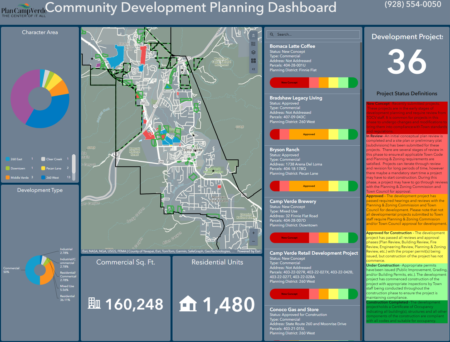
Active Development Projects Dashboard