
Utility and Public Works
Utility and public works departments often get pulled into answering the same questions—Where is the nearest valve? Which properties connect to this sewer line? What’s the maintenance history for this segment of pipe? Without a centralized system, staff spend valuable time digging through old plans or directing field crews by phone.
Interactive GIS maps change that. With a searchable, online utility map, anyone on your team can quickly locate infrastructure, view system details, and make decisions with confidence. Field crews get answers in seconds, and supervisors can focus on maintaining systems rather than managing information requests.
Give Your Utility & Public Works Team the Tools to Work Smarter
Utility and public works staff depend on accurate, accessible information—whether it’s locating underground utilities, planning maintenance, or responding to service requests. GIS brings all of that data together in a single, easy‑to‑use online map.
Instead of flipping through binders, tracking down old as‑builts, or relying on institutional knowledge, your team can instantly view water, sewer, and storm infrastructure from any device. Field crews get the info they need on the go, supervisors can spot issues before they become problems, and the public can access reliable information without calling your office.
Our maps are designed around your department’s daily work, making it easier to manage assets, support capital projects, and improve customer service—all while reducing time spent searching for information
Map Demos
-
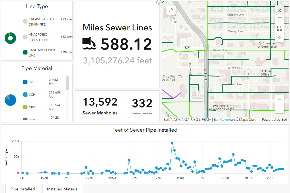
Sewer Dashboard
-
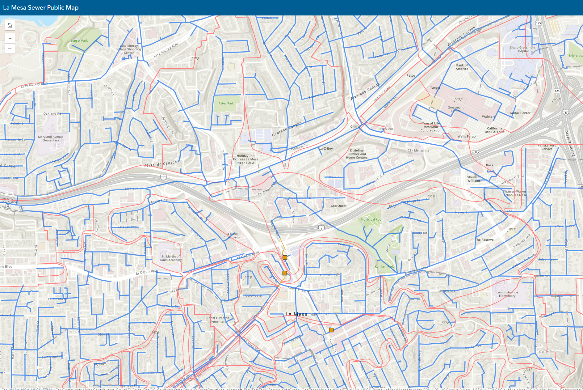
Public Utility Map
-
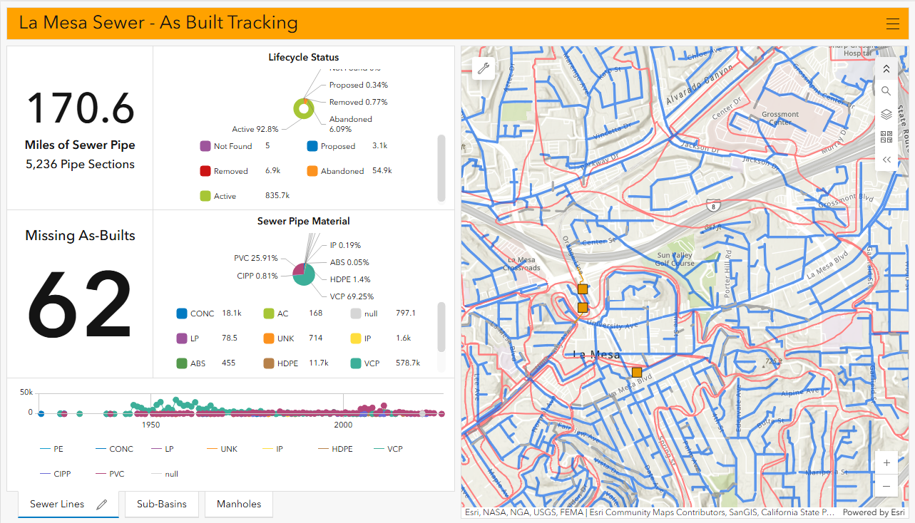
Sewer As-Built Tracking